
Sports
Sunny and very nice for late October.
By Marcus Chen
Advertisement · Why this ad?
Katherine oversees editorial operations across all six brands. Before joining The Meridan Group, she spent 14 years at the Minneapolis Star Tribune, where she led the metro desk through its digital transformation. She holds a Master's in Journalism from Northwestern's Medill School.
More from Katherine →As the afternoon sun casts a warm glow over the Twin Cities, residents brace for a significant shift in the atmosphere. Meteorologists warn that a potent combination of weather factors could unleash severe thunderstorms, bringing with them the potential for heavy rain, damaging hail, gusty winds, and even tornadoes across the metropolitan area.
This afternoon, severe thunderstorms, including the potential for tornadoes, are forecast for the Twin Cities and surrounding areas. Residents are urged to finalize their preparedness plans and remain vigilant as the weather system approaches, with the most intense activity expected between 4 p.m. and 6 p.m. across the core of the metro.
The National Weather Service (NWS) Twin Cities office has issued detailed advisories, indicating that these powerful storms will first begin to develop over southwest Minnesota in the early afternoon. Their trajectory is set to bring them into the western Twin Cities Metro area around 4 p.m., before sweeping through the core of Minneapolis and St. Paul closer to 5 p.m.
By approximately 6 p.m., the severe threat will be nearing the Minnesota/Wisconsin border, impacting the eastern Metro. During this critical 4 p.m. to 6 p.m. window, the storms carry the potential to produce not only heavy rain and hail, but also dangerous gusty winds and, most concerningly, tornadoes.
Forecasters point to intense wind shear as a primary factor contributing to the tornado risk. Winds at the surface will be blowing from the southeast, while at 5,000 feet, they will veer sharply to the southwest. This significant twist in the air overhead creates the rotational dynamics necessary for tornado formation, particularly during the peak threat period.
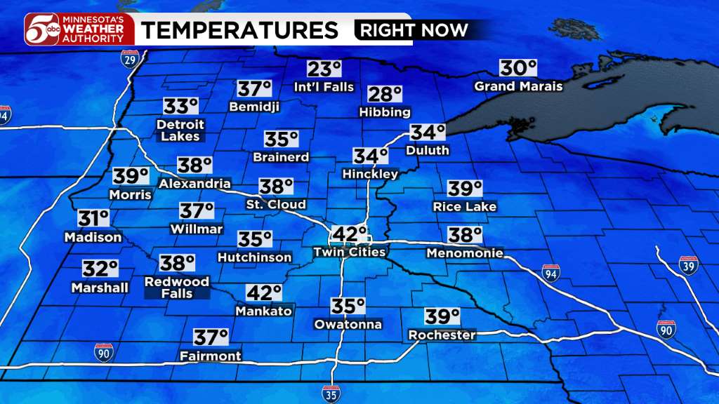
Ahead of the storms, temperatures in the Twin Cities are expected to be in the upper 60s to near 70 degrees. Coupled with dew point temperatures approaching 60 degrees, the air will feel noticeably muggy, adding to the atmospheric instability. After 6 p.m., the severe thunderstorm threat is expected to shift east of the Twin Cities, and no additional thunderstorms are anticipated overnight, offering a return to calmer conditions.
For families across the Twin Cities, this weather alert serves as a crucial reminder of the importance of preparedness. Many local households are already taking proactive steps, securing outdoor items like patio furniture and trampolines, and diligently checking their emergency supplies. These actions reflect a deep-seated commitment to protecting loved ones and property, a hallmark of our resilient community.
The spirit of neighborly care is also evident, with community members sharing updates and safety tips on social media platforms to keep everyone informed. This collective effort to disseminate information and offer support underscores the strong bonds that hold our neighborhoods together, especially when facing potential challenges.
Parents are taking extra precautions to ensure their children understand what to do in case of a tornado warning, reviewing family emergency plans and identifying safe spaces within their homes. Schools, such as those within Minneapolis Public Schools, often have their own protocols for severe weather, which families should also be familiar with.
The impending storms evoke a sense of urgency and collective concern, yet also a quiet determination. It's a time when the values of strong, intact families truly shine, as households come together to prepare, support each other, and pray for safety. This shared experience reinforces the foundation of our community, built on mutual care and vigilance.
As the afternoon progresses, residents should ensure all loose outdoor items are brought inside or firmly secured. This includes trash cans, garden tools, and children's toys, which can become dangerous projectiles in high winds. Checking on elderly neighbors or those who may need assistance with preparations is also a vital act of community kindness.
It is paramount for every family to have a designated safe room or shelter, ideally an interior room on the lowest floor of a sturdy building, away from windows. Practice drills with your family, ensuring everyone knows the plan, including how to access a weather radio or reliable alert system.
Access to accurate, real-time information is critical during severe weather events. The National Weather Service (NWS) Twin Cities provides the most up-to-date forecasts, watches, and warnings specific to our region. Their website and NOAA Weather Radio are indispensable tools for staying informed.
For broader state-level guidance on emergency preparedness and response, the Minnesota Department of Public Safety - Homeland Security and Emergency Management (HSEM) offers comprehensive resources. These state agencies work tirelessly to ensure communities are equipped to handle natural disasters.
Local government websites, such as the City of Minneapolis Official Website and Hennepin County Government, are also vital sources for local emergency declarations, service disruptions, and community-specific information. These platforms often provide details on potential shelter locations should they become necessary.
The American Red Cross - Minnesota Region is another invaluable resource, offering disaster preparedness information, shelter assistance, and support for individuals and families affected by severe weather. Their work is a testament to the power of compassionate service in times of need.
General safety tips for severe weather, including what to do during heavy rain and potential flooding, can be found on federal preparedness sites like Ready.gov and the EPA's guidance on flooding. These resources emphasize the importance of having an emergency kit and a communication plan.
Beyond immediate safety, considering the aftermath is also prudent. Information on home insurance and post-storm recovery can be found through the Minnesota Department of Commerce. Understanding your coverage before a storm hits can alleviate significant stress later.
As the Twin Cities prepares for the coming hours, the resilience of its people stands as a beacon. This community has faced and overcome many challenges, and each time, it emerges stronger, bound by shared experiences and a commitment to one another. The American dream of stable, loving households is often tested by nature, but it is in these moments that the true strength of family and faith shines through.
While the immediate threat is focused on the afternoon, the lessons learned from preparing for such events extend far beyond a single storm. They reinforce the importance of vigilance, community engagement, and the timeless values of protecting one's family and helping one's neighbor. Even as the severe threat moves east after 6 p.m., the preparedness mindset will linger, a testament to our collective wisdom.
The forecast reminds us that living in Minnesota means embracing all seasons, including the dynamic and sometimes challenging weather patterns of spring and summer. By staying informed, acting responsibly, and supporting each other, the Twin Cities community will navigate this afternoon's storms with grace and fortitude.
As the clouds gather overhead, the community stands united, ready to face the storm with resilience and vigilance, knowing that together, we are stronger.
By Marcus Chen
By Katherine Langford

By Katherine Langford

By Katherine Langford